Lesotho
The Kingdom of Lesotho. The name itself conjures with fantasy. Game of Thrones or Lord of the Rings perhaps. It is therefore little surprise that the director of Black Panther based parts of his fantastical land Wakanda on Lesotho and the Basotho tribesmen.
Lesotho means the land of the people who speak Sesotho. It is 30,000 sq km, population just over 2 million, and completely surrounded by South Africa. It is the highest independent state in the world, the lowest point is 1400 m, and this fact defines this unique mountainous kingdom. It has a history that reads like a Hollywood script, murder, mayhem plots and coups. Well worth some further research I'm thinking.
Anyway this unique country has been within a days drive of us for the last 30 years and, for some reason, we have never visited, except for a short diversion walking the berg when we got hopelessly lost. But that's another tale! So en route for home from Botswana it seemed a God given opportunity…….
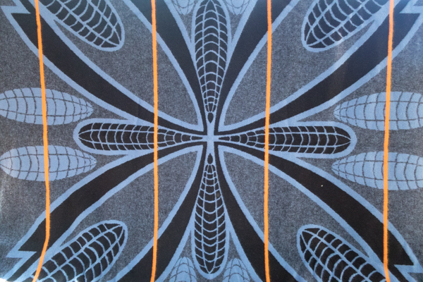
Basotho Blankets
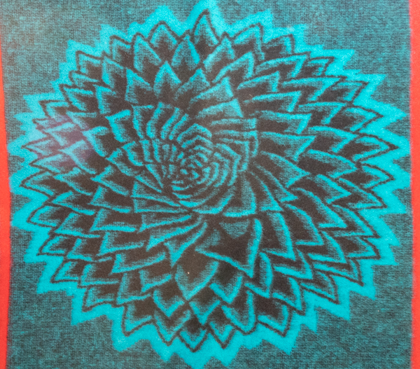
Corn sheaves, a sign of properity.
We drove down through Clarens to enter Lesotho by the Fouriesberg border. Clarens is always a welcome stopping place. It is such a pleasant place for a meal or a coffee, the artistic vibe is strong, the people a bit eccentric but friendly. There is an African blanket shop there which sells some of the original Basotho blankets and, seeing as we were heading for Lesotho, it seemed appropriate to invest in a couple. The temperature in the mountains can be cold even in the height of summer. Basotho blankets are beautifully made, mostly from merino wool, farmed in the highlands.
Those that are over 50% wool are almost rain proof, warm and water resistant. The colours and patterns reflect many symbols of prosperity, protection and good luck like corn sheaves and traditional shields. The story has it that the blanket became an adopted national custom after the king was gifted a blanket by Queen Victoria. He stopped using traditional animal skins and preferred the blankets which were adopted by the whole nation. Crowns and symbols of British royalty are also seen in the designs today. We bought 3 and we saw many of similar designs being worn by the men and women in Lesotho, although the colored blankets seemed to be reserved for the elders.
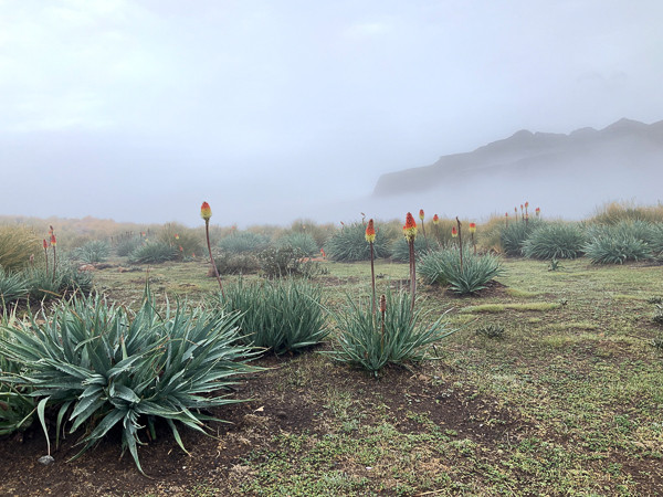
The spiral aloe, national flower of Lesotho.
First Glimpse
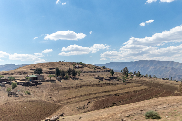
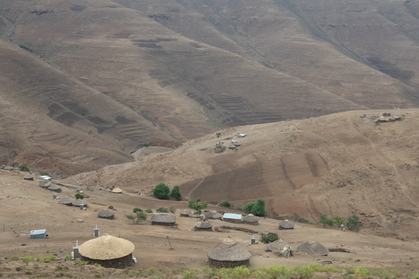
We crossed the border just outside Fouriesburg. The homes are very modest and the people live off the land but it looks like a hard job. 75% of the country is rural and survive off subsistence farming, particularly as pastoralists. It was clearly very dry. We had been warned in Clarens. Lesotho had a very bad rainy season last year and a poor snow fall. This year the rains were again late. We could see no crops to speak of although there was some rather messy terracing. It looked like they were waiting for the rains before planting. It is predicted that in the 2019-2020 season more than 500,000 people in Lesotho will be affected by food insecurity due to the current drought. Hard times indeed.
We saw lots of sheep and a few cows. More donkeys and horses. The sheep are two kinds, one with long hair and curly horns for the merino wool and the National blanket industry.
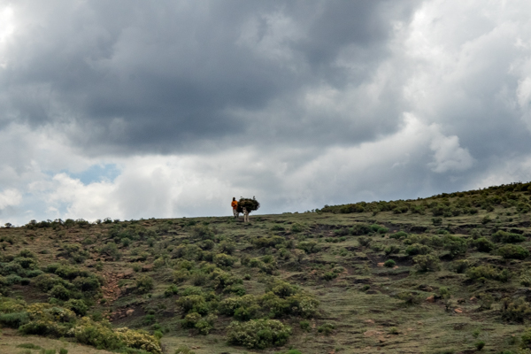
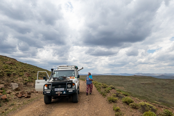
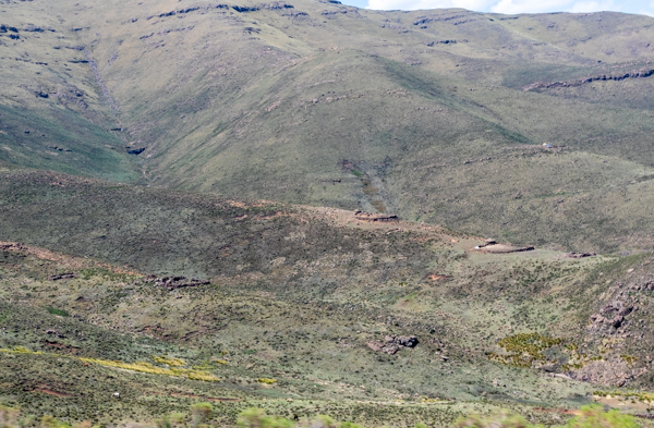
The mountains are steep so the villages are sometimes perched precariously on the slopes. There is evidence of a lot of over grazing and erosion but, as we climbed the switchbacks on rough and potholed roads over 3000m, the scenery, although remote and rough, was still beautiful. A slow process with the panting beast!
The people are curious but appear a little hostile. Most just put out their hands for handouts rather than greeting us. Boys were calling out they were hungry while trying to sell us fish with the other hand. It is cold at altitude and clearly harsh. The people look fit, slim and wiry. The tough little Basotho ponies trot along with their blanket clad owners. This country has the second highest incidence of HIV and TB. Child labor, sexual and domestic violence are acknowledged problems and nearly 50 % people live on less than $1.25 a day. There is no place to be critical. Lesotho has serious challenges.
Katze Campsite
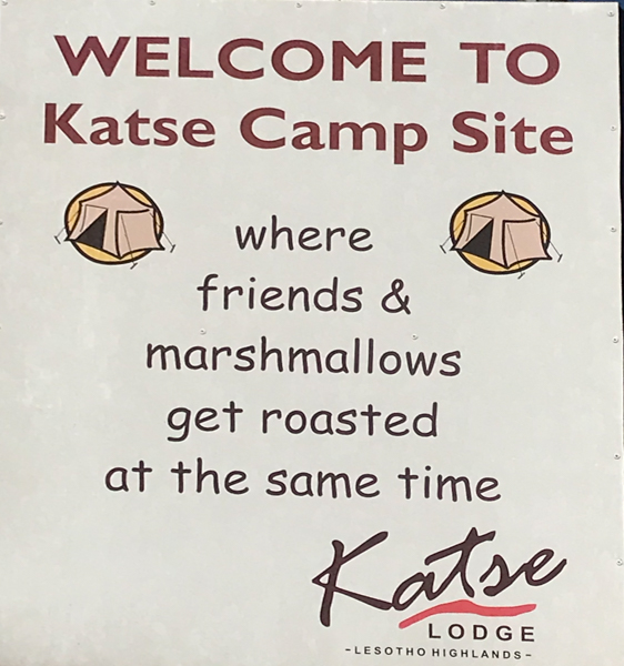
I had to blink a few times when I read the welcoming sign to Katze camp site. Possibly written by Hannibal Lechter!
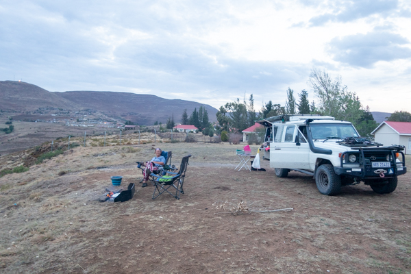
We headed for the famous highlands hydroelectric project at Katse Dam. We were drawn by the promise of decent camp site there, and we were not disappointed. Katse village, which sits on the edge of the dam, is reminiscent of a Mondi village. A little landscaped enclave with a small lodge. The lodge was full of Chinese businessmen. I predict some more road building in the planning!
We had a flat camp ground overlooking the dam to ourselves. A bleak and windswept plateau but with magnificent views. The blankets came in very handy!
Katze Botanical Garden
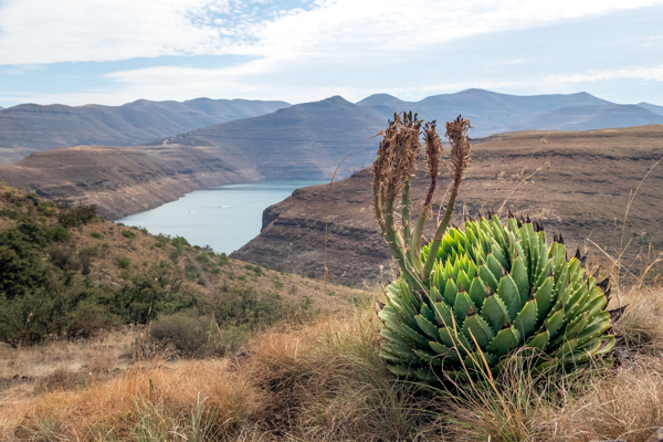
A couple of hundred meters down the road is the Katse Botanical Gardens and we swung in the next morning to look around. At 2229 m it is the highest botanical garden in the Southern Hemisphere and is arrayed around a series of meandering paths on the slopes above the dam.
It was started as a rescue mission to save some of the alpine plants threatened by the construction of the dam, particularly the national flower, the spiral aloe, and has become an important seed bank.
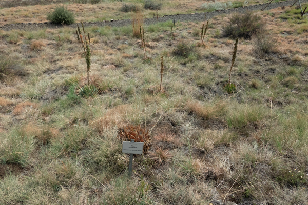
There is an extensive collection of plants used in traditional Sotho medicine. Even here the impact of the drought was evident, I fear some of the plaques were only marking the grave of the plants they were advertising. We saw the few trees of Lesotho, only about 6 or 7. This is not a forested kingdom. The Oude Hout was familiar from Drakensberg walks. There is lots of it at Highmoor. Anyway they say it is used to treat diabetes. It is also a good fire wood. The trees are rather spindly and stunted. A response to the harsh environment I suspect.
Katze Dam
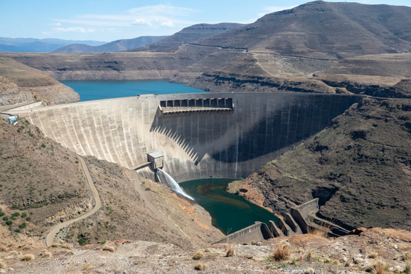
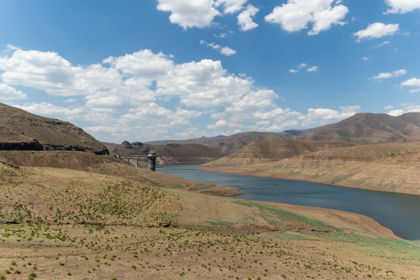
Next stop was the Katse dam, definitely a man made wonder. Our R30 entrance to the gardens included a free tour of the dam wall. Bonus! The dam water covers over 8000 hectares and the dam wall itself is the second largest concrete arch in Africa. It was conceptualised as an additional water supply for South Africa, and was built by multinational companies at a cost of over 8 billion dollars. It was completed in 1996 and was full by 1997. The hydroelectricity generated is used by Lesotho but still does not provide all their needs. This is only stage 1 of a proposed 4 stages and if they continue the development the hydroelectricity could see Lesotho self sufficient. Unfortunately the drought has put a big spanner in the success story of the dam. We found it to be only 18% full and this is the lowest level since it opened. It is losing water season by season.
We toured through the dam wall, a massive construction 15 stories high. We entered on the 8 th level, hard hats at the ready, and were treated to a comprehensive walk through, spotlessly clean and impressively engineered.
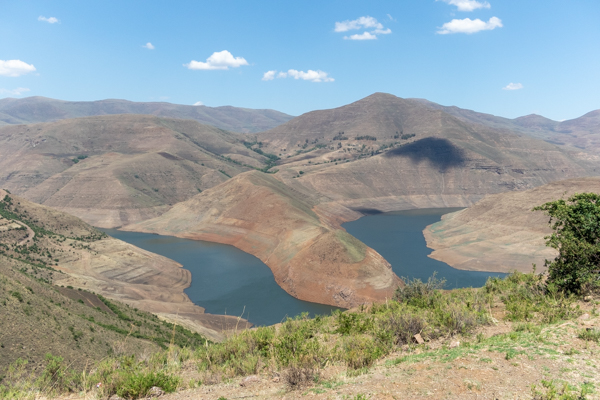
From the top of the wall you can look down on the little boats plying back and forward across the water. Many of them were bought by the displaced farmers with their compensation money, to run as tourist boats. The organisation and advertisement is lacking so I am not sure how successful this has been. It is said that efforts to reestablish the displaced population has not lived up to the expectations or promises.
The intake tower is 18 km north of the dam wall and 98 m high. Water flows from there through 45 km of pipe to the hydroelectric station and from there, through gravity feed, to South Africa. For now the people of Katse dam are concerned about global warming. South Africa may have to look elsewhere for their extra water supply. When we were in Clarens they had just had water cut off for several weeks because of maintenance issues and lack of rain fall.
The Mountains
Now it was time to move on. They don’t allow picnicking anywhere near the dam so we decided to drive out and find a breakfast spot. It is easier said than done.
Although the landscape is barren and harsh you are rarely out of sight of people, and if you stop they all come running. It’s like trying to hide a double decker bus in a field of buttercups. It is hard to deny food to people with no visible source of nutrition. As we climbed higher the landscape became brown and barren and the wind blew with an icy edge.
Animals grazed on dry earth. The homes were low stone bothys and stone cairns dotted the landscape. The men were huddled in blankets. They love to wear either a strange grass hat which is high in the crown with a low brim, or balaclavas. They travel light. It looks like a nation of bandits! Anyway we parted with packets of biscuits and apples as we weaved through the more remote places. This is about survival.
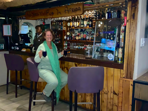
Highest Pub In Africa
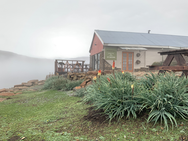
We bumped off the dirt roads onto the A1. This was a surprisingly good and clearly new road. Reportedly the work of the Chinese. We moved to the A14 which took us all the way to Sani. The nearer we got the greener the pastures, although it was mainly fynbos green and not grass. The cloud came down low as soon as we crested the highest point at Black Mountain, 3340 m. We soon could not see anything and we crept down some very steep hairpin bends towards the border.
Perched on the edge of the escarpment is the famous Sani Lodge. We arrived in the rain and could not see our hands in front of our faces.
We battled to find the entrance in the poor visibility, keenly aware that the wrong turn could throw us off a cliff. Anyway the homing instinct towards a warm fire and a cold glass of wine did not let us down. Serendipitously the camping was closed so we got snug in a rondavel. Expensive but with copious hot water, a fire and dinner and breakfast thrown in. This is the highest pub in Africa. 2874 m to be exact! What’s not to love. We listened to the rumble of thunder and watched the sunbirds on the aloes in the mist and rain. A momentary concern about tackling the Sani Pass in zero visibility and pouring rain was drowned in the Old Brown Sherry.
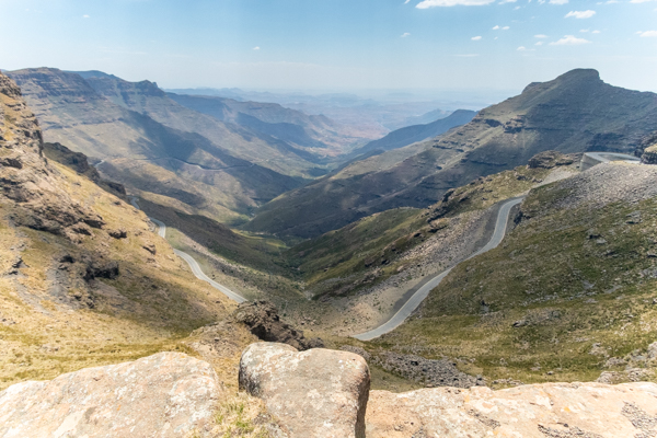
Sani Pass
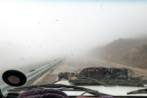
The morning dawned misty and wet but the downpour had passed. We checked with the experts who reckoned the pass was navigable , so we set off into the grey cloud. The top of the pass is steep and has a series of sharp hairpin bends including a particularly sharp one called “ reverse corner”. Here the trick is to pull onto the verge and then reverse back up the road to get the angle to get around the bend. Interesting but ultimately eminently doable and we glided down the pass with no problems. The plan is in place to tar the pass. I remain doubtful as to whether this is a good thing. I am not sure they quite understand the environmental and seasonal changes, and the engineering challenges and adaptations that will be needed. They have started the bottom end with a series of contractors that each get a small section to construct. Another source of concern I fear. Variable quality. We shall see.
As beautiful as the Sani pass was, the most amazing thing to us was the change in landscape the minute we left Lesotho. There was grass and greenery and lush landscape, and the rivers and streams were running and gurgling down the mountains. It would seem that on the eastern escarpment there was no drought and the rain had been unusually generous. Of course there was also a difference in grazing and in altitude but still. What a harsh reminder of the vagaries of nature. On this occasion, at least, to our benefit.
So we said goodbye to the Kingdom of Lesotho but for sure we will be back to explore more of its harsh beauty and fascinating culture and history.